Wednesday, April 3, 2019

Avintaquin Campground in the Ashley National Forest of Southeastern Utah

         For many years I drove by the turn-off for Avintaquin Campground and two questions came to mind:
         What's up with the unusual name?  and,  What's it like to camp there?

         According to the book Native American Place Names of the United States the word Avintaquin is "presumably from Ute, the translation is not clear".   So the answer to the first question is basically an unknown.

         To answer the second question I finally camped at Avintaquin, 15 years after first driving by that US Forest Service sign.  What's it like?  Splendid!
         And I now feel qualified to hazard a guess as to the Ute interpretation of Avintaquin.  How about: "Where the Earth Touches Sun and Stars".
     
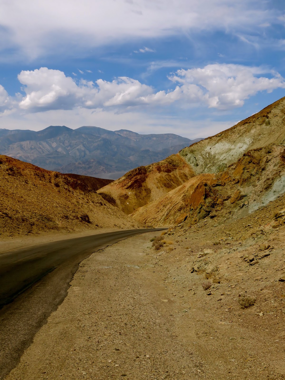
        At an elevation of 9000 feet this campground-in-the-sky certainly embodies a heavenly spirit.   The morning sun sets the tree-tops afire and the night sky glitters with starlight.  Situated among towering Douglas Fir trees and quaking Aspens, the sites possess commanding views of rolling valleys and distant mountains.

        Last summer our group of seven women and four dogs spent a dazzling June weekend in the group campsite at Avintaquin.  Nighttime and early morning temperatures dipped below freezing but a blazing campfire provided warmth and good cheer.
        We had such a good time that we reserved the group campsite for the July 4th holiday this year.


The spaciousness of the group campsite was an attractive feature of this campground.
Notice the large "kitchen", far removed from the sleeping quarters.


Temperatures drop in the early evening.
The campfire is ready to go!

Morning sun warms our tent site.
Bring your dogs!
Annie, Lucinda, Jax and Kala (left to right) had as good a time
camping as we women did!

       Avintaquin is not really on the way to anywhere but that's part of its appeal—far from the madding crowds.  If you've had enough of the mob scene in National Parks like Zion and Arches head for our National Forests.  You might discover a hidden gem like Avintaquin Campground.


Friday, February 22, 2019

Rock Art of Nine Mile Canyon, Price, Utah


         It's been called The World's Longest Art Galley.  Nine Mile Canyon cuts through the Book Cliffs Region and West Tavaputs Plateau of Eastern Utah, and the rock art it contains is intriguing and mysterious.

The Great Hunt. 

         My curiosity is piqued when viewing The Great Hunt Panel.  Who carved this?  How long did it take?  Was this done just to pass the time, or to convey information to passers-by?  Is the figure between the sheep at the top of the panel a "god of the hunt"?  Why is the hunter on the right—with bow and arrow—much larger than the hunters to the left and below him?  A Dad and his sons hunting together perhaps?  Why does a figure appear to be walking away from the hunt (lower right), and one of the sheep appear to be falling from the group?
       Part of the mystery of rock art is that we'll never know the answers to these questions.   The Fremont Indians who carved these figures lived in the canyon from 900 to 1200 A.D and then disappeared.
        For one thousand years though, their outdoor artwork has endured.

       Consider the panels below.  In the first one a giant bison-like animal appears alongside smaller animals and a person or two.  In the second one, people and animals are scattered about.  And why is one person lying on his side?  What are the scribblings between the two people and the animal in the center-right of the drawing?  Are some of these chiselings just a type of ancient graffiti?  Or could it be that the Fremont peoples continued to add to these al fresco drawings throughout their tenure in the canyon?  More intrigue, more mystery.

Apparently, large buffalo used to live here.
They were all exterminated by the European settlers.

A lot of incongruous activity is going on in this scene.

           Most people visit Nine Mile Canyon to see The Great Hunt Panel, but there are hundreds of rock art sites scattered along the canyon's 40 mile length.  Why is a 40 mile long canyon named Nine Mile Canyon?  The canyon is named for Nine Mile Creek, which cuts through it.

Picnic area under the shade of Cottonwood trees.

         When visiting Nine Mile Canyon during the spring, summer or fall, bring along a picnic lunch and relax for awhile.  The shaded picnic area provides the perfect spot for pondering the fascinating works within The World's Longest Art Gallery.

Tuesday, January 15, 2019

Feeling the Heat in Death Valley National Park, California


          Furnace Creek Campground on this mid-May morning is all furnace and no creek.

         As the mercury climbs I drag my camp chair into the meager shade of my Toyota Venza, take a sip of coffee, and ponder today’s options.  Where to go when I have only one full day to tour Death Valley National Park?

         A walk from the campground to the adjacent Visitor Center is in order.  I hastily wash the breakfast dishes, then collapse my tent with everything in it and place rocks on top of the whole pile—high winds are forecast for today and I’m not keen to return to camp and find an empty campsite, my tent and its contents scattered across the desert.


My Furnace Creek Campsite.  You can see the frame of my collapsed tent
behind the picnic table.

         At the visitor center I study the park map.  Death Valley N.P. is immense; at 3.4 million acres it’s the largest national park in the lower 48 states.  I formulate a plan to see as many highlights as I can. 
        A bout of lightheadedness and dizziness while in the visitor center—most likely the result of dehydration—convinces me to fill my water bottles and thermoses at the outdoor fountains, and to experience the park’s sprawling grandeur mostly from the comfort of my air-conditioned vehicle.  Today’s high temperature will reach 109°.

        First stop: Badwater Basin, the lowest spot in North America at 282 feet below sea level.  I’ll never stand atop the highest spot on the continent, 19,685 ft. Mt. Denali in Alaska, so might as well plant my feet in the lowest.  And it’s easy to do, as you can drive right up to the parking area, exit your car and walk a few hundred feet to the basin.  Mission accomplished! 


Here it is, the low point of our Western Hemisphere!

         From Badwater Basin I travel the park’s undulating roller coaster roadways, making stops at The Artist’s Palette, Natural Bridge, Mesquite Flats Sand Dunes, and Mesquite Springs.  During short hikes at each stop I guzzle more water and return to the comfort of my car.  I now understand why this is not high visitation season in Death Valley.  One upside: No crowds.


The dunes stretch for two miles and are fun to climb.
Few visitors brave the broiling sand today though.

Along The Artist's Palette scenic drive.

         Back at the campsite winds are raging and I notice a neighboring tent has blown into a clump of trees.  
        At dusk the winds subside and temperatures dip into the 90s.  I re-erect my tent and crawl inside. After gulping a pint of water, I aim a battery-operated fan at my head and drift off to sleep inside my 5’x7’ furnace within Furnace Creek.


Early morning is the time to photograph the shadows of Zabriskie Point.


Saturday, November 17, 2018

Historic Central Market in Lancaster, Pennsylvania

        
My sister (lower left) outside Lancaster's Central Market on
a cloudy November morning.

         
         Farmer's markets are all the rage.  Every city and town seems to be vying for the title of Coolest 21st Century Farmer's Market, describing themselves with adjectives such as "organic" "original" and "artisan".  But how about an authentic 18th Century Market?  
         Central Market in Lancaster, Pennsylvania is the hands-down winner in all of the above categories, providing market-goers with the bona-fide farmer's market experience in the same location for a remarkable 288 years.


         Here is how Wikipedia defines Central Market:


A public marketplace was deeded on this site in 1730 as part of the settlement of Lancaster. The marketplace was officially chartered by King George II on May 1, 1742, officially designating Lancaster as a market town. The Central Market occupies a portion of the original marketplace, with the first permanent building erected in 1757.

        You can't beat a farmer's market chartered by King George II.  And you can't beat the shopping at Lancaster's Central Market for all your holiday culinary needs.  The photos below provide a mouth-watering taste of Central Market's offerings.


Need celery?  This stand has you covered.


Gotta have a fresh turkey for your holiday table.

Don't forget the baked goods.

There's always room for whoopie pies!

Has this post whetted your appetite for old-fashioned country cooking?  If so, get out there and patronize a local farmer's market—even if it's one that hasn't been around for almost three centuries.


Monday, October 29, 2018

Scarecrow Bash, Del Norte, Colorado

         During its annual 'Scarecrow Bash' the town of Del Norte, Colorado invites local businesses to display their inspired creations.

         Enjoy a selection of this year's creative contest entries:


Sunday, October 7, 2018

Vermont Maple Madness


Every "Mom and Pop" business in Vermont sells Maple Syrup!


         You’ve heard of the Five food groups.  
         The State of Vermont has added a Sixth:  Maple

         Vermont is the number one maple syrup producing state in the country.  They're proud of it, and while you’re touring the state they don’t let you forget it.  During my last couple trips to Vermont I sampled these foods:

         maple cream, 
         maple sugar sprinkles,
         maple-leaf sugar candy,
         maple creemees (soft-serve ice cream),
         maple shakes,
         maple malts,
         maple french-roast coffee,
         maple-bacon ice cream,
         maple-bacon cream cheese,
         maple-chocolate topping,
         maple ricotta,
         maple-mustard dressing,
         maple scones,
         maple sparkler (a dessert liquor),
         maple sticky buns,
         maple sugar-coated walnuts and, of course,
         maple syrup.
       
       
         Let’s see, have I forgotten anything?  Oh yes, maple lemonade.
         Not surprisingly then, maple syrup is for sale everywhere.  There are the large “touristy” maple farms sure, but every small farm stand and general store sells maple syrup too.  As does almost every other business.   I saw signs reading “Hay and Maple Syrup”, and “Farm Supplies and Maple Syrup”. I expected to see a business advertising: “Tires and Maple Syrup”.  Perhaps I did.

        All of this maple madness begs the question:  "Is there such a thing as too much maple?"  
        My answer is....."No".  When in Vermont, saturate yourself in the Sixth food group!
        Readers, do you agree?


If I could, I would probably bring a jug this size of syrup home with me.


Tuesday, September 11, 2018

Totally Above Treeline: Horsethief Pack Trail in Colorado's San Juan Mountains

Sheep—not horses—graze at the Horsethief Pack Trail trailhead.
In the distance, 14,309' Uncompahgre Peak dominates the skyline.
Read about our previous summit of Uncompahgre here.
         
         Sometimes the perfect day aligns with the perfect trail.  On the final Thursday of August in Lake City, Colorado the sky was sparkling blue, the temperature was a comfortable 72 degrees, and I was in the mood for a hike with big rewards and not too much effort. Tim had a place in mind.  
           "How about that trail near the top of Engineer Pass?" he said.  And I agreed.      

            Horsethief Pack Trail starts at an elevation of 12,400' and over the course of a few miles the trail gains and loses little more than a couple hundred feet of elevation.  A bit of exertion is required due to decreased oxygen levels at that altitude, but the real effort is getting to the trailhead.  The 16 mile dirt road leading from Lake City to Engineer Pass is rough; 4-wheel drive is needed for the final 6 miles and the going is slow—it takes over an hour to drive those 16 miles.

           But after arriving at the top of the world the arduous drive is forgotten.   The trail starts with 360° views of the surrounding mountains and keeps getting better.
           As Tim, Annie and I walked along, pikas and marmots serenaded us with their chattering and chirping calls.   Most likely they were scolding Annie but she didn't seem to notice.  Annie did notice, though, a group of camouflaged White-tailed Ptarmigan nestled in a rocky chute.  She flushed the birds but thankfully didn't chase them.
        The Ptarmigan scurried away to bed down in a nearby rock-strewn meadow, and Tim and I were treated to as fine a view as we've ever had of these alpine and tundra game birds.
         We hiked for a few miles, then stopped for lunch near a hillside rock cairn.   This would be our turn-around point, but the trail continues above treeline for several more miles.

         The perfect totally-above-treeline trail on the perfect day?  You decide.

The trail's beginning immediately affords views of several of the San Juan
Mountain's 13,000 and 14,000 foot peaks.

Annie loves nothing more than a cool high-alpine hike.

Tiny American Lake (center of photo) is a side destination on this hike.

Tim and Annie find the right spot for a  refreshing alfresco lunch.

Marmots surveyed and scolded us from the fields and rocky ledges.

A cute little pika watches us pass by.

One of the group of White-tailed Ptarmigan, showing off its summer plumage.
During winter the ptarmigan turn white, and are camouflaged by snow.

This photo shows the White-tailed Ptarmigan expertly camouflaged by the rocks.
Can you find the Ptarmigan?
Click on the photo to enlarge.  The black arrow (top left) points to the head of the bird.