Saturday, December 23, 2017

I'm Dreaming of a White Christmas....in the Utah Desert?

         While northern Utah's mountains—known for "The Greatest Snow on Earth"—await their first major snowfall, a winter solstice storm blanketed Arches and Canyonlands National Parks with 6-8 inches of the fluffy white stuff.

          Enjoy these red-rock snowscapes.  Wishing you a white Christmas—if only in your dreams.


Balanced Rock,  Arches National Park

Turret Arch, Arches National Park

North Window Arch, Arches National Park

Canyonlands National Park, Island in the Sky District


Sunday, December 3, 2017

A November Hike in the San Rafael Swell of Southeastern Utah

         November is the perfect time for a desert outing and last Sunday six friends and I hiked the Horsethief Canyon Trail in The San Rafael Swell.  I've posted stories from this hike before, but this was the first time the goal was the overlook—a 7 mile out-and-back trek.  Our group spent four hours exploring this part of "The Swell" and during that time we encountered only two other hikers.
       
         If the San Rafael Swell was located in another state—Iowa for instance—it would be the premier tourist attraction.  In Utah however, The Swell competes for visitors with our state's 5 national parks and 7 national monuments.  Therefore those of us who live in southeastern Utah have this 1,280,000 acre recreation area mostly to ourselves.  And that's okay with me.

        Below are the photos from last weekend's Swell hike.

The trail into the canyon.

This trail has it all, a sandy wash, desert vegetation, rocky spires, and...

... slickrock hiking.
Also plenty of interesting rocky shelves along the way.

The view from the overlook.


The dogs—Annie (left) and Lucinda—loved this hike too!
As a matter of fact, Horsethief Trail was Annie's first desert hike.
Read about it here.

The group hangs out at the overlook.

Weather-sculpted features along the trail.

Annie (left center) leads the way out of the canyon.


Saturday, October 21, 2017

What Is There To Do After You Arrive in Isle Royale National Park?

         
Another day of action and adventure dawns in Isle Royale National Park.


         A Yellowstone tour guide once told me: 
         “Get out on the trails and you’ll have the park all to yourself, because most of the tourists spend all of their time in the gift shops and bathrooms.”

         In Isle Royale National Park it’s exactly the opposite.  People go to Isle Royale to experience the outdoors and immerse themselves in it.  Everywhere you look you see backpacks, kayaks, canoes, day packs, hiking poles.  
       
         Visitors to Isle Royale don't snap selfies from scenic overlooks or drive around gawking at the sights.  They don't drive at all, because the park prohibits motor vehicles.  If you want to experience Isle Royale you'll have to walk or paddle your way around.  Because of this, Isle Royale has one of the longest visitation averages (the amount of time a visitor stays) in the country.

         Although the 45 mile-long island boasts 165 miles of trails and is dotted with backcountry campgrounds Tim and I didn't bring our backpacking gear on this trip.  We stayed in Rock Harbor Lodge on the eastern end of the island.  From the lodge we accessed the park's trail system, rented a canoe, and booked an excursion on the Sandy, a 30 person sightseeing boat.

         In my previous post I explained how to get to Isle Royale National Park.  The following photos will help to answer the question posed in this post's title.

         Sightseeing
         The Sandy offers sightseeing tours to remote parts of the island and to various off-shore islands.  We chose a half-day excursion on the Sandy to Moskey Basin, home to Rock Harbor Lighthouse and the Wolf-Moose Research Center.

The Sandy (green and white boat) is docked in front of Rock Harbor Lodge.

The research project documenting the interaction between wolves and
moose on the island is the longest continuous study (almost 60 years)
of any predator-prey system in the world.

Every antler tells a story.  Researcher Candy Peterson shares her stories from
40 years of researching the moose-wolf dynamic on Isle Royale.


The trail to the lighthouse passes through a green-glowing moss-lichen forest.

Rock Harbor Lighthouse heralds the entrance to Rock Harbor passage.


         Hiking
         We hiked trails to the east and west of Rock Harbor Lodge.  Some trails hug the shoreline of Lake Superior or inland bays, others traverse the deep woods of the island's interior.

Elevated boardwalks on the Scoville Point trail resemble balance beams.
Here I'm perfecting my Simone Biles (US Gold-medal winning gymnast)
impersonation.


Scoville Point is the easternmost point on Isle Royale.
After reaching the point we take a break to read and relax.


Along the Tobin Harbor Trail Tim stops to watch a loon and her chick.
If you've never heard the call of a loon in the wild you are missing
out on one of the great things about being alive.


         Paddling
         Isle Royale is a paddler's paradise.  You can chose to circumnavigate the island or paddle the many miles of inland lakes, streams and coves.

No, these fancy stream-lined kayaks aren't ours.  The Ranger III transported these
vessels to the island for two men from Michigan, who planned to spend a week exploring the island.


Tim and I rented this canoe and paddled the relatively
calm waters of Tobin Harbor.

        I have to add that a unique aspect to this park is the absence of cell service.  That's right, no cell service anywhere on the island, even in the lodge and visitor center.  I noticed something extraordinary while walking the footpaths and trails of Isle Royale—people looking up instead of down, truly noticing their surroundings, engaging with those around them instead of with people far, far away.   It was so social.  And so pleasant.

        Isle Royale may not have the grand scenery of a Yellowstone, Yosemite or Grand Canyon.  But the entire park is designated wilderness and it's a place that invites visitors to get out of the indoors, to explore and discover the world around them.


Sunday, October 1, 2017

Where in the World is Isle Royale National Park? And How Do You Get There?

         
Here it is.  Isle Royale National Park—(black arrow)—
is encompassed and dwarfed by Lake Superior.
Green hatched lines show ferry routes to the park.


         Three things have long intrigued me about Isle Royale National Park:

         1) The entire park is a designated wilderness area.
         2) It’s one of the least-visited national parks, getting fewer people in a year than Yellowstone gets in a day.
         3) Isle Royale is remote.  Surrounded as it is by the vast inland sea that is Lake Superior, it's not easy to get to.

         To visit this national park, you have to really want to go. 
         And I really wanted to go.

         Now, how to get there?   Three different ships sail to Isle Royale and they're all on different schedules.  A seaplane serves the island but its schedule is highly dependent on weather conditions.  Coordinating my itinerary with available transportation to and from the island was like solving a puzzle.  

         The dizzying array of transportation choices are shown and described below.  See the map above to locate the various ports and seaplane bases.   See the map below for island details.

Isle Royale Seaplane


The seaplane can be chartered from Houghton, Michigan or Grand Portage, Minnesota.
Here, the plane lands on the relatively protected waters of Tobin Harbor
on the eastern edge of the island.


Passengers ready to board at the Tobin Harbor "terminal".  No TSA!


The Isle Royale Queen

"The Queen" sails out of Copper Harbor, Michigan and makes its three hour run
every day.  The ride on this ship is described as nausea-inducing.


The Voyageur II


The Voyageur II sails from Grand Portage, Minnesota and typically provides service
around the entire island every two days.  It does not run on Fridays.

The Ranger III

The Ranger III sails into Rock Harbor.  This 165 foot sea-worthy vessel
was built in 1958 and has been serving the national park service ever since.
The Ranger III arrives in Rock Harbor on Tuesdays and Fridays and
departs on Wednesdays and Saturdays.


Let's review the options.

         The Seaplane?  Because of the unpredictable weather and my inherent fear of small planes, the seaplane is out.
         The Isle Royale Queen?  Having read the Queen described as "The Barf Wagon of the Sea", I don't think so.
         The Voyageur II?  Its schedule did not fit ours and I wanted to leave from Michigan and not Minnesota.  And besides, just look at it!

         Two other (not practical for us) transportation choices were available.  The Sea Hunter III sails from Grand Portage, Minnesota to Windigo Harbor but does not continue on to Rock Harbor, home to the Visitor Center, lodge and restaurants.
         Also, you may paddle your own kayak or canoe to Isle Royale from the mainland.  This has been done exactly twice since the park was established in 1940.  Lake Superior has recorded 40 foot waves, so this option seems either very brave, or very foolish.

         After careful deliberation I chose the vessel operated by the National Park Service.  The Ranger III—the largest passenger ferry service to the park—is also the largest moving piece of equipment owned and operated by the National Park Service.   Note that large is the operative word here.  Lake Superior is notorious for its storms and rough seas and, as I am prone to extreme motion sickness, a sturdy mode of transport seemed the logical choice.


The Ranger III as seen from our hotel across the street on the morning of
our departure.  The Ranger III sails from Houghton, Michigan and makes
its six-hour trip across Lake Superior twice a week from early June
until early September.


Luggage and kayaks are loaded on the Ranger III before the passengers board.


Please click on this map to enlarge and view details
of Isle Royale.

         The pieces have come together, the puzzle has been solved and Tim and I have arrived at the park.  
         Why the passive construct (Never use the passive voice!) in the previous sentence, and throughout this post?  After researching this trip, my active voice was exhausted.
          Rest assured that voice will return in the next post, where I'll describe what to see and do in Isle Royale National Park.


Wednesday, August 2, 2017

Warner Lake Campground in the Manti LaSal Mountains of Southeastern Utah

       
Do you like the idea of spending a weekend here?
If so, read on.  If not, well, please read on anyway!

         Mention the words "girl's getaway" and these images may come to mind:  luxuriating with spa treatments and yoga at an Aspen ski lodge; sipping coffee and/or cocktails on the deck of a Key West villa; shopping and dining, then attending a play in New York City's theater district.

         Now compare the above scenarios with sleeping in a tent on the ground, cooking on a gas stove, eating at a picnic table, and using an outhouse.  That's how the girls—okay, middle-aged women—in my outdoor adventure group spent our end-of-June girl's getaway weekend.

         Warner Lake Campground is situated in an aspen grove in the Manti LaSal National Forest, southeast of Moab, Utah.  The 9,200 ft. elevation makes the campground cool in the evenings and comfortable during the days.  The group campsite—at the outer edge of the campground loop with views of the lake and surrounding mountains—is one of the prettiest mountain campsites I've been in.

        While the setting for this getaway was spectacular and the nine women on the campout shared an easy camaraderie, it was the perfect weather which made this vacation a resounding success.  Each morning we relaxed with coffee, then ate breakfast, hiked a mountain trail, took afternoon naps in the tents (for those who needed them), had wine and hors d' oeuvres in the late afternoon, cooked tasty dinners and, finally, relaxed around crackling campfires at night.

         I have nothing against Aspen, Key West, or New York City and I'm sure I would enjoy myself in any of those locales.  But this primitive alpine getaway to Warner Lake Campground proved as invigorating as a spa treatment, as relaxing as a day at the beach, and as enlightening as an evening in the Big Apple.  The perfect "girl's getaway".

Women of the Castle Country Canyoneers prepare for a morning hike.

View from the top of the appropriately named "Mountain View Trail".
"Dog-tired" after a morning hike.  Two girl dogs—Lucinda on the left and
Teva on the right—accompanied the women on this getaway.

Here's where we cooked and ate.
Can any NYC restaurant compare with this?

Evening campfire in the group campsite.

This is the view that greeted me from my tent each morning.
What a way to start the day.

Sunday, July 9, 2017

Great Basin National Park's Untrampled Trails

         Readers of this blog may remember my series of posts beginning last June, titled "Nevada Beyond the Neon".  I began that series with a trip to Great Basin National Park and mentioned a few of the park's must-see highlights, including several trails.

         Last month I returned to Great Basin N.P. and, after spending four days there, I was reminded once again of why it's one of my favorite places.  Not only is it a beautiful park but the trails are well-maintained and signed, the campgrounds are pristine, and the location can't be beat.  Also, no crowds!

         I've read that on a bad day the Delicate Arch Trail in Arches National Park may see 3000 pair of feet.  On this most recent trip to Great Basin my friend Shirley and I hiked three trails—Pole Canyon, Serviceberry and Alpine Lakes Loop—and we encountered a grand total of 24 other trekkers.

         Want to know what it's like to visit an "undiscovered" national park?  Find out by traveling to Great Basin in Nevada and chose almost any trail.  You'll be rewarded with scenery, silence, and solitude.

Pole Canyon Trail:

This large Aspen tree frames a view from the
Pole Canyon Trail.


Wildflowers along the Pole Canyon Trail.


Serviceberry Trail:

Serviceberry Trailhead.


Shirley along the Serviceberry Trail.  We didn't see anyone else on
this trail, or on the 13 mile drive to the trailhead.


Alpine Lakes Loop Trail:

Shirley and Rita along the Alpine Lakes Loop Trail.


Stella Lake.  This would make a good base camp for an ascent of
13,064' Wheeler Peak—top, left-center.


Snowfields along the Alpine Lakes Loop trail.


Teresa Lake, South end.  A scene such as this called out for John Muir.
So Shirley and I sat on this log and
read from a John Muir book of quotations.


Teresa Lake, north end, with a view of Wheeler Peak.


To read last year's post on Great Basin National Park, click here.

Please note that wildfires and mudslides along Lexington Creek Road have rendered the road to Lexington Arch trailhead all but impassable for the last several miles. The road is mostly on Bureau of Land Management (BLM) land and the BLM has no plans to improve it.  This has made the hike to Lexington Arch—previously a 3 mile round trip—into a more difficult (no shade) 7-10 mile round trip.   Contact a Great Basin National Park ranger for more details.

Friday, June 2, 2017

The Fork in the Road: Our Stay in Whiskey Grove Campground on the Green River, Wyoming

"When you come to a fork in the road, take it..."
                                                                                                                      ... Yogi Berra

Yogi Berra's witty and sage advice led us to discover Green River Lake,
the headwaters of the 730 mile-long Green River.
Squaretop Mountain, in the center, is one of Wyoming's iconic images.
          Road Closed 70 Miles Ahead.  Uh oh.  Our planned stop for the night, Warren Bridge Campground, is along that stretch of road.   I consulted my Wyoming map and camping guides and what do you know?  A fork in the road, just before the closure, led to an alternative campground—Whiskey Grove, north of Pinedale along the west side of the Wind River Mountains.  I think we'll take that fork.

Road Closed.  A massive forest fire in the Bridger-Teton National Forest
closed a 50 mile stretch of Highway 191 in Wyoming and generated this
pink smoke cloud visible from  40 miles away.

        
          Just to be sure we'd made the right decision, Tim and I stopped at the Pinedale Visitor Center where I chatted with the pleasant older couple behind the information desk.
      
         “We had planned to camp at Warren Bridge tonight,” I said.  “But now we’re thinking about Whiskey Grove instead.”
         “Whiskey Grove?,” they said.  "Why that’s our favorite campground in the area.  Much nicer than Warren Bridge.”
         “What’s the story with the road closure?,” I asked.
         “A lightening strike yesterday ignited a fire in the national forest, spanning both sides of the highway.  They say the road will be closed for several days.”
         “Will the campground be crowded then?” 
         “Shouldn’t be,” they replied.  “Most folks traveling through here are headed for Grand Teton and Yellowstone National Parks.  This afternoon we’ve had to send them on a 2-3 hour detour to get there.  You shouldn’t have a problem securing a campsite in Whiskey Grove.”

         Our change of plans affirmed, Tim and I drove the lonely road to Whiskey Grove.  To the west the sky filled with billowing purple-pink smoke.  Thirty minutes later we pulled into Whiskey Grove and found it mostly deserted.  And delightful.  
         The campground is located in a bend in the Green River and nestled in an isolated pocket of pine trees.  Rolling hills and evergreens surrounded our spacious campsite along the river.
         After setting up camp Tim spent an hour fishing the Green.  He wasn’t disappointed, catching a couple good-sized rainbow trout.

Our spacious campsite in Whiskey Grove Campground.


Tim and Annie fish the Green River, just down the hill from our campsite.


         We spent a mostly idyllic four days at Whiskey Grove.  Why mostly idyllic?  Well, we discovered two negatives to the area.  
         Our first night in the tent we woke at 1:00 a.m. to a deafening roar; heart-stopping, unnerving, menacing.  The noise was so loud and frightening I was sure a jumbo jet had crashed into a nearby hillside.  Later we learned this valley is a night training ground for fighter pilots and their jets.  
         The other issue? "Killer" insects patrol this area—mosquitoes and biting flies.  On the first evening I counted 35 bug bites.  That night in the tent I clawed relentlessly at the itching, stinging welts on my legs and ankles.

         I can imagine readers thinking to themselves:  Wow, that sounds like fun. Not!

         But here’s the thing.  In spite of the fighter jets and the bugs I would stay at Whiskey Grove again.  In a heartbeat.  Far from the madding crowds, in the near pristine setting of the headwaters of the Green, our three night home-away-from-home proved a destination worthy of our unplanned detour.  My advice?  Heed Yogi Berra, the late, great MLB All-star catcher and manager of The New York Yankees:  The next time you're traveling and you come to that fork in the road, take it! Wherever it may lead.

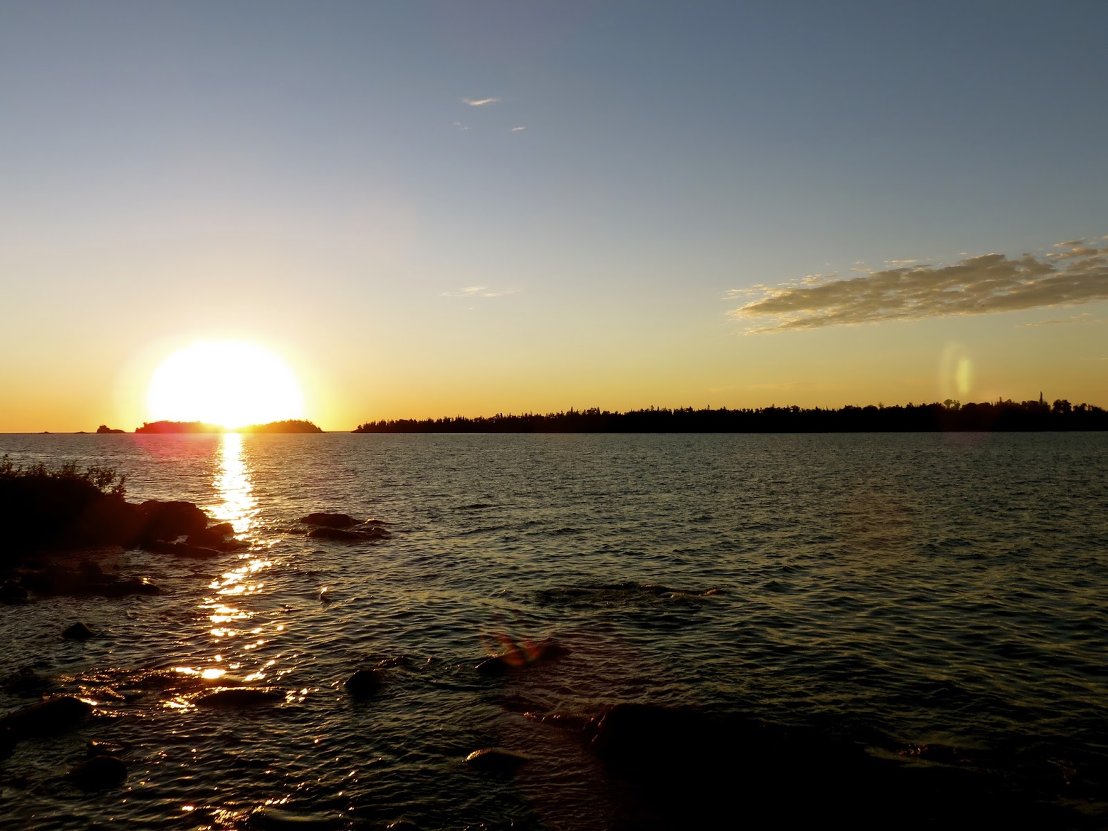
Looks like a wonderful evening around the campfire, doesn't it?
In reality I was eaten alive by bugs at this very spot.


In a scene that could be straight from a movie, range-riders trot across the sage-covered hills
while Tim fishes the meandering Upper Green River.