One Day in America celebrated its 10th anniversary in March of 2021. To commemorate the occasion I chose to share ten former posts written about destinations I have visited only once, but long to see again.
 |
| Sandhill Cranes take flight at Bosque del Apache National Wildlife Refuge. |
****
1. Redwoods State and National Parks, California. A stroll through California's Redwood forests should be required of every human. This may sound like hyperbole but I nominate Redwood Trees for the title: 'Earth's Greatest Living Beings'. I would like nothing more than to walk among the giants again. Feel small and insignificant—but in the best possible way—by clicking here.

****
2. White Sands National Park, New Mexico. Surely there are other phantasmagorical locales on our planet. But when you arrive at White Sands—as I did on a March day with few other visitors—and gaze upon the endless folds of white, you can't help but feel as though you're living a dream. My goal is to return and camp overnight in this ethereal world. Live the dream here.
 |
| A lone hiker in the White Sands. |
****
3. North Captiva Island, Florida. You know how we're advised to visualize our "happy place" when we're feeling stressed or sad? Well, North Captiva Island off Florida's Gulf Coast qualifies as one of my happy places. You can't help but smile when you're watching White Pelicans dip and soar while listening to the ebb and flow of the tide. Upon arriving home from North Captiva I vowed to go back within a few years. I regret to admit it's been 24 years and I have yet to return to this happy place. But, don't worry, be happy... and click here.
 |
| White Pelican conference on North Captiva Island. |
****
4. Bosque del Apache National Wildlife Refuge, New Mexico. I have witnessed many a spectacular sunset, but the sunsets—and sunrises too—at Bosque del Apache are beyond spectacular. Add to it the cacophony of tens of thousands of migratory birds, and you have an "I can't believe I'm alive to witness this" experience. Share in the magic, by clicking here.
 |
| Sunset in Bosque del Apache National Wildlife Refuge. |
****
5. Trail of the Coeur d' Alenes, Idaho. If you have a road bike and don't want to cycle in traffic, this 72 mile paved rail trail is the way to go. Spanning Idaho's panhandle, this easy trail is a delight. You'll ride past marshlands, woodlands and welcoming small towns. Go along for the ride, by clicking here. |
| Crossing a lake in Idaho's panhandle on The Trail of the Coeur d' Alenes. |
****
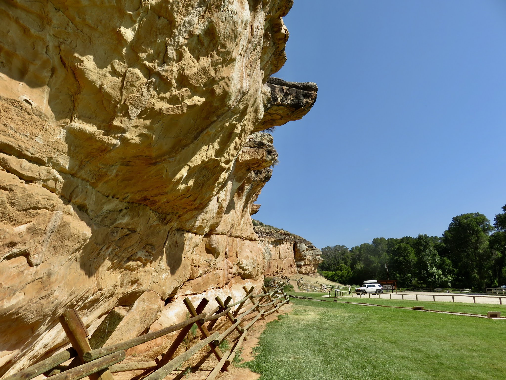
6. Hovenweep National Monument, on the Colorado/Utah border. The treasures of Hovenweep inspire reverence for the ancient inhabitants of our continent. The Puebloan ruins there have stood for an amazing 10,000 years. Be amazed by the ancients here.
 |
| A ruin with a view, in Hovenweep National Monument. |
****
7. Berlin-Ichthyosaur State Park, Nevada. A gold and silver mine and giant prehistoric fish-lizard bones? Yes, artifacts of both can be found in this park which was once a great inland sea. Intrigued? Satisfy your curiosity here.
 |
| A return to this desert campground in Berlin-Ichthyosaur S.P. would be fine with me. |
****
8. Crater Lake National Park, Oregon. To those who have never been there, your first view of Crater Lake will take your breath away. When you begin to breathe again you will continually blink your eyes to be sure the vision in front of you is real. The magnificent blue reflected back to your eyes is the result of the lake's depth and clarity. To read about another of the lake's wonders, or, if blue is your favorite color (it is mine), click here.
 |
| You can stop pinching yourself now. The color is real. |
****
9. Coyote Buttes, Arizona. This is a tough one. Do I wish I could return to this geologic wonderland? Yes, I do. But in reality, like too many wondrous places in America, Coyote Buttes has been "discovered". To protect this fragile area only a certain number of visitation permits are issued per day. And while it was once easy to secure a permit in the off-season (I was there one January) people now wait years to secure a lottery permit, or wait in long lines at the BLM office to snag one of a handful of first-come-first-served daily permits. The area is worth a visit, but it will take some effort to do so. Check out the surreal landscape here, then decide whether or not to get on the waiting list.
 |
| The next time you complain about the wind, behold what the wind can do. |
****
10. Medicine Lodge Archeological Site State Historic Park, Wyoming. When Tim and I drove into this park in July of 2020 I thought: This could be any old campground in any old place. We stayed for two nights, but I wished we could have stayed much longer. Medicine Lodge has an indescribable allure. It could be the wildlife, the wilderness, the archeology and paleontology, or even the blue-ribbon trout stream. Whatever it is, the attraction is strong. And before you realize it, you know you're in one of Wyoming's special places. Experience the enchantment of this park by clicking here.
 |
| Not just any old place. Medicine Lodge takes hold of you. I will return. |